Where the Land Simply Stops: The Making of Moher
The story of Ireland’s most famous precipice is a three-hundred-million-year-old battle between an ancient river and a relentless ocean.
This story began with a question: “Why are the cliffs of Moher so dramatic?”
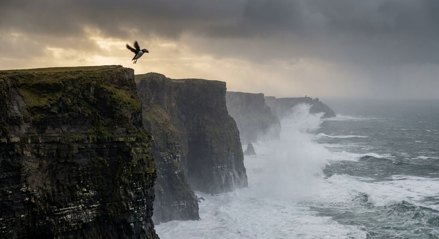
If you stand at the edge of O’Brien’s Tower on a day when the Atlantic gale is at its peak, the world seems to dissolve into two colors: a deep, churning charcoal grey and a violent, frothing white. Below your feet, the land doesn't gently slope into the sea; it simply stops. The Cliffs of Moher drop vertically for over 700 feet, a wall of jagged shale and sandstone that looks less like a natural formation and more like a fortress built to keep the ocean at bay.
To understand why these cliffs are so hauntingly steep and dramatic, you have to look past the sheer drop and into the layers of the stone itself. Those horizontal stripes, visible like the pages of a massive, water-logged book, are the fingerprints of a river system that existed long before Ireland was even an island.
The Ghost of an Ancient River
Three hundred million years ago, during the Carboniferous period, the ground you are standing on was located near the equator. It was a time of colossal geological shifts, and what is now County Clare sat at the mouth of a massive river delta. This wasn't a babbling brook; it was a sprawling, silt-heavy monster, similar to the modern Mississippi or the Amazon.
As the river flowed, it carried vast quantities of mud and sand from distant mountains, dumping them into a deep marine basin. Over millions of years, these sediments settled in distinct layers. The heavier sand created sandstone, while the finer silt and mud compressed into darker shale and siltstone. This rhythmic stacking is why the cliffs have their famous "layer cake" appearance. You aren't just looking at a cliff; you are looking at the compressed debris of a prehistoric world, stacked nearly 200 meters high.
The Sculpting Hand of the Atlantic
The drama of Moher isn't just about how the rock was made, but how it is being destroyed. The Atlantic Ocean is one of the most powerful erosive forces on the planet. For millennia, the full weight of the ocean’s swell—having traveled thousands of miles across open water—has slammed into this specific stretch of the Irish coast.
The "dramatic" verticality of the cliffs is a result of a process called "block failure." Because the rock is made of alternating layers of hard sandstone and softer shale, the ocean eats away at the soft layers at the base first. This creates undercuts and sea caves. Eventually, the weight of the overhanging sandstone becomes too much for gravity to ignore. Massive vertical slabs of the cliff face simply shear off and collapse into the surf, leaving behind a fresh, perfectly vertical wall.
This process means the cliffs are constantly retreating, moving inland inch by inch over centuries. The jagged stacks you see standing out in the water, like the famous Branaunmore sea stack, are the lonely survivors of the former cliff line—pillars of rock that were just stubborn enough to resist the waves a little longer than the land around them.
A Sanctuary in the Mist
While the geology provides the stage, the life inhabiting the cliffs provides the soul. The very features that make the cliffs terrifying to humans—the sheer drops, the inaccessible ledges, and the howling winds—make them a paradise for seabirds. During the spring and summer, the cliffs become a deafening, swirling metropolis for over 30,000 pairs of birds.
Atlantic Puffins, with their colorful beaks and awkward waddles, burrow into the grassy slopes at the very top, while Razorbills and Common Guillemots huddle on the narrowest stone ledges halfway down the precipice. To see them from above is to realize that the drama of Moher isn't just geological; it is a precarious, high-stakes theater of survival. The birds rely on the updrafts created by the cliff face to launch themselves into the wind, navigating a landscape where a single misstep means a plummet into the churning foam.
The Human Watchtower
Humans have always been drawn to this edge of the world, though usually for more practical reasons than a selfie. The name "Moher" comes from an old Irish word for a ruined fort, Mothar, which once stood on Hag’s Head, the southernmost point of the cliffs. That fort was demolished during the Napoleonic Wars to make way for a signal tower, a stone sentinel intended to warn of a French invasion that never came.
In the mid-19th century, a local landlord named Cornelius O’Brien realized that people were beginning to travel just to see the view. He built a viewing tower and paved paths with the local "Moher stone"—slabs of Liscannor flagstone that are famous for the fossilized trackways of prehistoric sea creatures preserved on their surfaces. O'Brien understood something that remains true today: there is something fundamentally humbling about standing at the limit of the terrestrial world.
The cliffs remain dramatic because they represent a raw, unfinished conversation between the earth and the sea. They are a monument to the power of water—the ancient river that built them and the modern ocean that is slowly, relentlessly taking them back. Standing there, with the salt spray on your face, you are witnessing a moment in a three-hundred-million-year-old vanishing act.
This story travelled through
Where does this story take you next?
Every story opens a door somewhere else. Pick a thread and we'll tell you that story too.
Curious about something else?
Discover another exploration